Showing 34 items matching archaeological survey
-
 Greensborough Historical Society
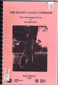
Book, Victoria Archaeological Survey, The Plenty Valley Corridor: the archaeological survey of Aboriginal sites / by Isabel Ellender 1989, 1989_
... The Plenty Valley Corridor: the archaeological survey of...This archaeological survey of th Plenty Valley...Victoria Archaeological Survey... Corridor: the archaeological survey of Aboriginal sites / by Isabel ...This archaeological survey of th Plenty Valley was conducted by Isabel Ellender in 1989 for the Ministry of Planning and Environment. The area studied is north of Greensborough to Whittlesea. A number of Aboriginal sites were identified and recommendations made for the future.103 p., illus., maps. Plastic spiral binding.plenty river, aboriginal heritage sites -
 Eltham District Historical Society Inc
Document - Folder, Victoria Archaeological Survey, 1982-1990
... Victoria Archaeological Survey...Victoria Archaeological Survey... and Metropolitan Archaeological Survey, Ministry for Conservation Victoria...Folder Document Victoria Archaeological Survey Contents: 1 ...sites, structures, archaeological significance, victoria archaeological survey -
 Victorian Aboriginal Corporation for Languages
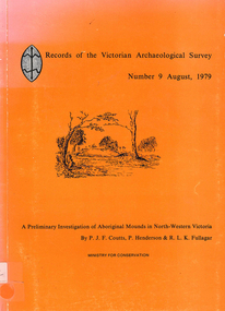
Book, PJF Coutts et al, Records of the Victorian Archaeological Survey : number 9, August 1979 : a preliminary investigation of Aboriginal mounds in North-Western Victoria, 1979
... Records of the Victorian Archaeological Survey : number 9...Victoria Archaeological Survey... Archaeological Survey : number 9, August 1979 : a preliminary ...Maps, charts, graphs, b&w photographs, diagramsvictoria archaeological survey, murray valley, grampians -
 Whitehorse Historical Society Inc.
Document, Melbourne and Metropolitan Archaeological survey, 1/03/1982
... Melbourne and Metropolitan Archaeological survey...Victoria Archaeological Survey... Archaeological survey History of Aboriginal occupation of the Melbourne ...History of Aboriginal occupation of the Melbourne area. Evidence of shell midden refuse associated with their campsites. Evidence of scarred trees and scatters of stone artefacts along major stream systems. It has been established that man was in the Melbourne area 40,000 years ago and that Aboriginal occupation probably continued uninterrupted throughout the extremes of the last ice age, around 20,000 years ago when Port Phillip itself was dry land. Study will take 2 - 3 years. Aims (1) identify areas of potential archaeological importance (2) implement a pilot survey program (3) prepare comprehensive proposals for survey of sites. (4) liaise and establish rapport with municipal authorities in study area.aborigines, wurundjeri, bunurong, australian heritage commission, victoria. ministry for conservation, victoria archaeological survey -
Whitehorse Historical Society Inc.
Book, Archaeological Survey, 1/05/2000 12:00:00 AM
... Archaeological Survey...An archaeological survey at Deep Creek and Loughnan Roads... Mitcham melbourne Book Book Archaeological Survey ...An archaeological survey at Deep Creek and Loughnan Roads, Mitcham Victoria.An archaeological survey at Deep Creek and Loughnan Roads, Mitcham Victoria. Project No 1660. Survey prepared for Vicroads as part of the preparation for the Eastern Freeway.An archaeological survey at Deep Creek and Loughnan Roads, Mitcham Victoria. historic buildings, archaeology, eastern freeway extension, deep creek road, mitcham, loughnan road, ringwood, vicroads -
Federation University Historical Collection
Booklet, Preserving Our Archaeological Heritage
... victorian archaeological survey...Victoria Archaeological Survey... archaeological survey aboriginal sites aboriginal statements register ...Nine page booklet with a ohotograph of a buried dingo skeleton on the cover. contents include: * Legislation Relating to Aboriginal Relics * Register of Aboriginal Sites * Site protection and Preservation * Archaeological Research * Coastal midden * Lake Condah * Archaeological Relics Advisory Committee * Community Education, Training and Information * What to do when youfind a relicarchaeology, victorian archaeological survey, aboriginal sites, aboriginal statements, register of aboriginal sites, glenaire rock shelter, lake condah fish trap, st arnaud rock wells, carisbrook archaeological area -
Koorie Heritage Trust
Document - Printed Sheets, Bennett, Catherine et al, Report on Aboriginal Skeletal Remains from Tarwin Meadows, South Gippsland - site number 80201/043, 1986
... Victorian Archaeological Survey-Aboriginal Skeletal Remains...Victorian Archaeological Survey; Melbourne... Archaeological Survey-Aboriginal Skeletal Remains Bennett, Catherine ...30 P.; appendices; maps; figs.; tables; plates; 32 cm.skeletal remains-aboriginal-tarwin meadows-south gippsland, anthropology-aboriginal-south gippsland., victorian archaeological survey-aboriginal skeletal remains -
 Greensborough Historical Society
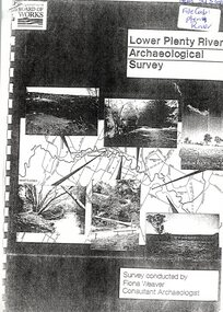
Report, Lower Plenty River Archaeological Survey; Fiona Weaver, 1989_
... Lower Plenty River Archaeological Survey; Fiona Weaver...Archaeological survey of the Lower Plenty River undertaken... Archaeological Survey; Fiona Weaver Printed on white A4 paper. Approx 92 ...Archaeological survey of the Lower Plenty River undertaken in 1989-1990 by Fiona Weaver for the Board of Works. Indigenous heritage sites along the Plenty River are examined and recommendations made for the preservation and to lessen the impact of development on these sites.Printed on white A4 paper. Approx 92 pages (not numbered). Illus., maps. 2 copies.plenty river, board of works, aboriginal heritage sites -
![Book - Article, Fiona Weaver, Lower Plenty River Archaeological Survey by Fiona Weaver [excerpt], 1991](https://victoriancollections.net.au/media/collectors/62fc2e8d3b4c83fe7f279a1c/items/6450d73a49371722cf4f2ee8/item-media/6450d9b949371722cf4f5830/item-fit-380x285.jpg) Heidelberg Golf Club
Heidelberg Golf ClubBook - Article, Fiona Weaver, Lower Plenty River Archaeological Survey by Fiona Weaver [excerpt], 1991
... Lower Plenty River Archaeological Survey by Fiona Weaver...Excerpt from Lower Plenty River Archaeological Survey... Book Lower Plenty River Archaeological Survey by Fiona Weaver ...Excerpt from Lower Plenty River Archaeological Survey by Fiona Weaver. Section 5 on Aboriginal archaeological sites in the Lower Plenty River area.A survey of First Nations sites in the Lower Plenty River area.Copy of part of book.lower plenty river, aboriginal sites -
 Greensborough Historical Society
Book, Isabel Ellender, The Plenty Valley Corridor: the archaeological survey of Aboriginal sites / by Isabel Ellender 1991, 1991_
... The Plenty Valley Corridor: the archaeological survey of...This archaeological survey of the Plenty Valley... Corridor: the archaeological survey of Aboriginal sites / by Isabel ...This archaeological survey of the Plenty Valley was conducted by Isabel Ellender in 1991 for the Board of Works (Melbourne Water), in particular the Plenty Gorge Metropolitan Park. The area studied is north of Greensborough to Whittlesea. A number of Aboriginal sites were identified and recommendations made for the future.67 p., illus., maps. Plastic spiral binding.plenty river, aboriginal heritage sites, plenty gorge metropolitan park -
 Victorian Aboriginal Corporation for Languages
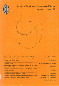
Book, Records of the Victorian Archaeological Survey : number 10, June 1980, 1980
... Records of the Victorian Archaeological Survey : number 10... Archaeological Survey : number 10, June 1980 Maps, charts, graphs, b&w ...Maps, charts, graphs, b&w photographs, diagrams -
Federation University Historical Collection
Booklet - Book, Burra Lotjpa Dunguludja: Victorian Aboriginal Justice Agreement Phase 4, 2018
... Victoria Archaeological Survey... koori justice unit Victoria Archaeological Survey ...Burra Lotjpa Dunguludja means 'Senior Leaders Talking Strong' in Yorta Yorta language.Sixty page book aiming to continue to address Aboriginal over-representation across the justice system, and to progress self-determination as the core policy approach. The vision was to ensure Aboriginal people have access to n equitable justice system that is shaped by self-determination, and protects and upholds their human, civil, legal and cultural rights.aboriginal, martin pakula, tont lovett, marion hansen, aboriginal justice, aboriginal justice caucus, message stick, koori justice unit -
Koorie Heritage Trust
Book, Brown, Anne, Koorie Bush Tucker of the Murray Basin, 1992
... Victorian Archaeological Survey... Archaeological Survey ...Accompanied by detailed charts this booklet explores the bush tucker of the Murray Basin Aborigines and the methods they used to obtain these foods.15 p.; ill.; tables; footnotes, bib.Accompanied by detailed charts this booklet explores the bush tucker of the Murray Basin Aborigines and the methods they used to obtain these foods.aborigines, murray basin - bush tucker., hunting and gathering - murray basin, aborigines. -
Koorie Heritage Trust
Book, Burke, Christine, Analysis of the lithic assemblage from the Keilor archaeological site : site number : 7822/010, 1990
... Victorian Archaeological Survey; La Trobe University..., Christine Victorian Archaeological Survey; La Trobe University ...58 P. appendices; bib. graphs; figs. map.sites - conservation and protection. | keilor /? maribyrnong river (melbourne vic sj55-05) | excavations (archaeology) -- australia -- melbourne (vic.) sites - conservation and protection -
Koorie Heritage Trust
Document - Printed Sheets, Bennett, Catherine, A report on the Aboriginal Skeletal Remains from the Chenery Burial, near Skipton, Site Number: 7522/20, 1987
... Victorian Archaeological Survey; Melbourne... Archaeological Survey; Melbourne ...29 P.; Appendices; plates; figs.; tables; refs.; 33 cm.skeletal remains-aboriginal-chenery near skipton vic. -
Koorie Heritage Trust
Booklet, Brown, Anne, Aborigines in the environment, 1992
... Melbourne : Victorian Archaeological Survey... invasion. Brown, Anne Melbourne : Victorian Archaeological Survey ...This book examines three of the environmental zones of south-easternAustralia in the period immediately before white invasion.pp.26; illus.; figs.; This book examines three of the environmental zones of south-easternAustralia in the period immediately before white invasion. aboriginal australians -- victoria -- antiquities. | aboriginal australians -- victoria -- hunting. | aboriginal australians -- victoria -- food. | human ecology -- victoria. -
Tatura Irrigation & Wartime Camps Museum
Audio Tape, Walking tour of Camp 1 with Jenny Dumble who conducted an archaelogical survey thereof, 1990
... archaeological survey... completed an archaeological survey of the camp remains. Members of T... with Jenny Dumble who had just completed an archaeological survey ...Walking tour of camp 1 with Jenny Dumble who had just completed an archaeological survey of the camp remains. Members of T & D Historical Society accompanied.audio tape 90 minutesCamp 1 Jenny Dumblejenny dumble, archaeological survey, camp remains -
 The Beechworth Burke Museum
Photograph, c1930
... Archaeological survey... Village and Wodonga. Archaeological surveys were completed... surveys were completed by Austral Archaeology, which was done when ...Taken on 25 October 1930, various houses with the Hume Dam under construction are depicted in the background. The construction of the Hume Dam took place from 1919 to 1936. At the time of construction, it was the second largest dam in the world. It was also one of the earliest civil projects developed after the Federation. Some of the Dam workers consisted of World War I veterans. Dam workers often settled their families in Mitta Junction Village and Wodonga. Archaeological surveys were completed by Austral Archaeology, which was done when the Department of Land & Water Conservation was doing work to improve Hume Dam. The archaeological report that came out of the survey recommended three sites of interest where archaeological excavation should be done: Camp Ganger’s Quarters, Stableman’s Quarters, and the Industrial Dump. The excavation uncovered artefacts. Mitta Mitta: Mitta Mitta is situated between Mount Welcome and Mount Misery. It is named after the river that explorers Hume and Hovell discovered in 1824. The town would eventually become a huge gold mining town. Mitta Mitta is called Midamodunga by the local Indigenous peoples Wodonga: Wodonga is situated on the Murray River and is part of North East Victoria. Hume and Hovell: Hamilton Hume (1979-1873) and William Hilton Hovell (1786-1875). W. H. Hovell was born in Norfolk England and Hume was born in Parramatta, New South Wales Hovell and Hume undertook an exploration journey in 1824 and thought they discovered a river, which turned out to be the Murray River. They returned home in 1825, but returned to the area in 1826 and discovered coal in the area. This photo is historically significant as it shows the Hume Dam under construction in 1930. The Dam was named after Hamilton Hume, who is an important historical figure for this area as he helped discover the area where resources were found.Sepia rectangular photograph printed unmountedReverse: 84-19-5 / 1997.3185/ Values & spillway. / When completed the wall / will be as high as the / scaffolding. [featuring trademark: kodak print]construction, houses, veterans, mitta junction village, hume dam, world war i, federation, wodonga, archaeological survey, excavation, austral archaeology, department of land & water conservation, camp ganger's quarter's, stableman's quarters, industrial dump, artefacts, mitta mitta, mount welcome, mount misery, murray river, hamilton hume, william hilton hovell, hume and hovell expedition -
 The Beechworth Burke Museum
Photograph, c1930
... Archaeological survey... Village and Wodonga. Archaeological surveys were completed... surveys were completed by Austral Archaeology, which was done when ...Taken on 25 October 1930, various houses with the Hume Dam under construction are depicted in the background. The construction of the Hume Dam took place from 1919 to 1936. At the time of construction, it was the second largest dam in the world. It was also one of the earliest civil projects developed after the Federation. Some of the Dam workers consisted of World War I veterans. Dam workers often settled their families in Mitta Junction Village and Wodonga. Archaeological surveys were completed by Austral Archaeology, which was done when the Department of Land & Water Conservation was doing work to improve Hume Dam. The archaeological report that came out of the survey recommended three sites of interest where archaeological excavation should be done: Camp Ganger’s Quarters, Stableman’s Quarters, and the Industrial Dump. The excavation uncovered artefacts. Mitta Mitta: Mitta Mitta is situated between Mount Welcome and Mount Misery. It is named after the river that explorers Hume and Hovell discovered in 1824. The town would eventually become a huge gold mining town. Mitta Mitta is called Midamodunga by the local Indigenous peoples Wodonga: Wodonga is situated on the Murray River and is part of North East Victoria. Hume and Hovell: Hamilton Hume (1979-1873) and William Hilton Hovell (1786-1875). W. H. Hovell was born in Norfolk England and Hume was born in Parramatta, New South Wales Hovell and Hume undertook an exploration journey in 1824 and thought they discovered a river, which turned out to be the Murray River. They returned home in 1825, but returned to the area in 1826 and discovered coal in the area.This photo is historically significant as it shows the Hume Dam under construction in 1930. The Dam was named after Hamilton Hume, who is an important historical figure for this area as he helped discover the area where resources were found.Sepia rectangular photograph printed unmountedReverse: 84-19-2/ 1997.3188/ These are the four / release valves they are / not always open (illegible) this / when closed the water flows / over the spillway. [featuring trademark: kodak print] photograph number: 354construction, houses, veterans, mitta junction village, hume dam, world war i, federation, wodonga, archaeological survey, excavation, austral archaeology, department of land & water conservation, camp ganger's quarter's, stableman's quarters, industrial dump, artefacts, mitta mitta, mount welcome, mount misery, murray river, hamilton hume, william hilton hovell, hume and hovell expedition -
 The Beechworth Burke Museum
Photograph, 25 October 1930
... Archaeological survey... Village and Wodonga. Archaeological surveys were completed... Village and Wodonga. Archaeological surveys were completed ...Taken on 25 October 1930, various houses with the Hume Dam under construction are depicted in the background. The construction of the Hume Dam took place from 1919 to 1936. At the time of construction, it was the second largest dam in the world. It was also one of the earliest civil projects developed after the Federation. Some of the Dam workers consisted of World War I veterans. Dam workers often settled their families in Mitta Junction Village and Wodonga. Archaeological surveys were completed by Austral Archaeology, which was done when the Department of Land & Water Conservation was doing work to improve Hume Dam. The archaeological report that came out of the survey recommended three sites of interest where archaeological excavation should be done: Camp Ganger’s Quarters, Stableman’s Quarters, and the Industrial Dump. The excavation uncovered artefacts. Mitta Mitta: Mitta Mitta is situated between Mount Welcome and Mount Misery. It is named after the river that explorers Hume and Hovell discovered in 1824. The town would eventually become a huge gold mining town. Mitta Mitta is called Midamodunga by the local Indigenous peoples Wodonga: Wodonga is situated on the Murray River and is part of North East Victoria. Hume and Hovell: Hamilton Hume (1979-1873) and William Hilton Hovell (1786-1875). W. H. Hovell was born in Norfolk England and Hume was born in Parramatta, New South Wales Hovell and Hume undertook an exploration journey in 1824 and thought they discovered a river, which turned out to be the Murray River. They returned home in 1825, but returned to the area in 1826 and discovered coal in the area.This photo is historically significant as it shows the Hume Dam under construction in 1930. The Dam was named after Hamilton Hume, who is an important historical figure for this area as he helped discover the area where resources were found.Sepia rectangular photograph printed unmountedReverse: 84-19-6/ 1997.3187/ The spillway [featuring trademark: kodak print] construction, houses, veterans, mitta junction village, hume dam, world war i, federation, wodonga, archaeological survey, excavation, austral archaeology, department of land & water conservation, camp ganger's quarter's, stableman's quarters, industrial dump, artefacts, mitta mitta, mount welcome, mount misery, murray river, hamilton hume, william hilton hovell, hume and hovell expedition -
 The Beechworth Burke Museum
Photograph, 25 October 1930
... Archaeological survey... Village and Wodonga. Archaeological surveys were completed.... Archaeological surveys were completed by Austral Archaeology, which ...Taken on 25 October 1930, various houses with the Hume Dam under construction are depicted in the background. The construction of the Hume Dam took place from 1919 to 1936. At the time of construction, it was the second largest dam in the world. It was also one of the earliest civil projects developed after the Federation. Some of the Dam workers consisted of World War I veterans. Dam workers often settled their families in Mitta Junction Village and Wodonga. Archaeological surveys were completed by Austral Archaeology, which was done when the Department of Land & Water Conservation was doing work to improve Hume Dam. The archaeological report that came out of the survey recommended three sites of interest where archaeological excavation should be done: Camp Ganger’s Quarters, Stableman’s Quarters, and the Industrial Dump. The excavation uncovered artefacts. Mitta Mitta: Mitta Mitta is situated between Mount Welcome and Mount Misery. It is named after the river that explorers Hume and Hovell discovered in 1824. The town would eventually become a huge gold mining town. Mitta Mitta is called Midamodunga by the local Indigenous peoples Wodonga: Wodonga is situated on the Murray River and is part of North East Victoria. Hume and Hovell: Hamilton Hume (1979-1873) and William Hilton Hovell (1786-1875). W. H. Hovell was born in Norfolk England and Hume was born in Parramatta, New South Wales Hovell and Hume undertook an exploration journey in 1824 and thought they discovered a river, which turned out to be the Murray River. They returned home in 1825, but returned to the area in 1826 and discovered coal in the area.This photo is historically significant as it shows the Hume Dam under construction in 1930. The Dam was named after Hamilton Hume, who is an important historical figure for this area as he helped discover the area where resources were found.Black and white rectangular photograph printer unmountedReverse: 84-20-1/ 1997.3147construction, houses, veterans, mitta junction village, hume dam, world war i, federation, wodonga, archaeological survey, excavation, austral archaeology, department of land & water conservation, camp ganger's quarter's, stableman's quarters, industrial dump, artefacts, mitta mitta, mount welcome, mount misery, murray river, hamilton hume, william hilton hovell, hume and hovell expedition -
 The Beechworth Burke Museum
Photograph, 25 October 1930
... Archaeological survey... Village and Wodonga. Archaeological surveys were completed.... Archaeological surveys were completed by Austral Archaeology, which ...Taken on 25 October 1930, various houses with the Hume Dam under construction are depicted in the background. The construction of the Hume Dam took place from 1919 to 1936. At the time of construction, it was the second largest dam in the world. It was also one of the earliest civil projects developed after the Federation. Some of the Dam workers consisted of World War I veterans. Dam workers often settled their families in Mitta Junction Village and Wodonga. Archaeological surveys were completed by Austral Archaeology, which was done when the Department of Land & Water Conservation was doing work to improve Hume Dam. The archaeological report that came out of the survey recommended three sites of interest where archaeological excavation should be done: Camp Ganger’s Quarters, Stableman’s Quarters, and the Industrial Dump. The excavation uncovered artefacts. Mitta Mitta: Mitta Mitta is situated between Mount Welcome and Mount Misery. It is named after the river that explorers Hume and Hovell discovered in 1824. The town would eventually become a huge gold mining town. Mitta Mitta is called Midamodunga by the local Indigenous peoples Wodonga: Wodonga is situated on the Murray River and is part of North East Victoria. Hume and Hovell: Hamilton Hume (1979-1873) and William Hilton Hovell (1786-1875). W. H. Hovell was born in Norfolk England and Hume was born in Parramatta, New South Wales Hovell and Hume undertook an exploration journey in 1824 and thought they discovered a river, which turned out to be the Murray River. They returned home in 1825, but returned to the area in 1826 and discovered coal in the area. This photo is historically significant as it shows the Hume Dam under construction in 1930. The Dam was named after Hamilton Hume, who is an important historical figure for this area as he helped discover the area where resources were found. Black and white rectangular photograph printer unmountedReverse: 1997.3145/ 84-20-2construction, houses, veterans, mitta junction village, hume dam, world war i, federation, wodonga, archaeological survey, excavation, austral archaeology, department of land & water conservation, camp ganger's quarter's, stableman's quarters, industrial dump, artefacts, mitta mitta, mount welcome, mount misery, murray river, hamilton hume, william hilton hovell, hume and hovell expedition -
Federation University Historical Collection
Document, Eureka Stockade Site, 1991, 14/05/2014
... Stockade by Iain Stuart of the Victoria Archaeological survey... by Iain Stuart of the Victoria Archaeological survey The Eureka ...The Eureka Stockade was attached on 03 December 1854. It is not certain where the actual site of the stockade is. Ten typed pages of notes relating to the site of the Eureka Stockade by Iain Stuart of the Victoria Archaeological surveyeureka, eureka stockade, eureka stockade site, phillip clingin, iain stuart, eureka, eureka stockade, eureka stockade site, phillip clingin, iain stuart -
Marysville & District Historical Society
Article (item) - Book Extract, Aboriginal History, Unknown
... victorian archaeological survey... college victorian archaeological survey hume and hovell molesworth ...An extract from a book regarding a brief history of the Kulin nation of the North Central district of Victoria.An extract from a book regarding a brief history of the Kulin nation of the North Central district of Victoria. This history covered is both prior to European history and post-European history. The extract also covers current (1991) status of Aboriginal affairs and European settlement of the area.kulin nation, woiworung, taungurong, bunurong, watherong, jajowrong, wurrundjeri-willam, waring-ilam-balluk, goulburn valley, acheron valley, upper goulburn district, eildon-thornton, eildon homestead, o'rourke, thornton, assistant protector thomas, yarra valley, kilmore, mount william, jt gellibrand, william buckley, major mitchell, port phillip, murray river, yorta yorta, yowung-illam-balluk, waring-illam-balluk, ngurai-illam-wurrung, kurnai nation, protectorate system, victoria, george robinson, chief protector, willam thomas, james dredge, edward parker, charles sievewright, central board for the protection of aborigines, presbyterian mission, anglican mission, moravian mission, wonga, munnarin, beaning, murrin murrin, parugean, baruppin, koo-gurrin, acheron river, little river, acheron run, peter snodgrass, stephen jones, barak, dividing range, black spur, watts river, badger creek, healesville, coranderrk, victorian christmas bush, aboriginal and torres strait islander heritage protection act 1984, archaelological and aboriginal relics preservation act 1972, camp jungai, rubicon, warrawa college, victorian archaeological survey, hume and hovell, molesworth, broadford, william hamilton, alexandra, mansfield, avenel, tallarook, worrough, john cotton, trawool valley, seymour, pyalong, gold mining, central victoria, strath creek, reedy creek, yea, jamieson, marysville, jordan goldfields, comet mine, wandong, melbourne-albury railway, rabbit plague, narbethong, lord kitchener, puckapunyal military camp, 1944 decentralisation policy, eildon weir, hume freeway bypass, timber industry, australian paper manufacturers mill -
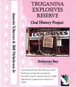 Truganina Explosives Reserve Preservation Society Inc (TERPS)
Digitised Oral History – Truganina Explosives Reserve - Tape 8 Annette Xibarras and Bill Nicholson Jnr, 2018
... archaeological survey... Julia Jones Princess Balam Balam archaeological survey middens ...The interviews were recorded in 2000 by Bronwen Gray and Alan Young for the production of Unreserved, Stories from Truganina Explosives Reserve, animated stories from past residents, workers and interested people of the Reserve (subject to copyright 2004). Annette Xibarras and Bill Nicholson Jnr discuss the indigenous significance of the Truganina Explosives Reserve. At the time of the interview Annette was the manager of the Kulin Nations Cultural Heritage Organisation. Bill, a Wurundjeri Elder, was a Wurundjeri Cultural Officer. They discussed their childhood, aboriginal customs, connection with the land and the locating of aboriginal remains at the Museum of Victoria and the re-burial at the site where they were found. A primary source of information on memories of the Truganina Explosives Reserve and Altona,VictoriaDigital copy of original cassette recorded in 2000 and digitised in 2018julia jones, princess balam balam, archaeological survey, middens, wurundjeri, kulin nations, coranderrk, braybrook, sacred sites, mt william, bunurong, museum victoria, altona, martha nicholson -
Tatura Irrigation & Wartime Camps Museum
Booklet, VAS News, 1989
... Newsletter of the Victoria Archaeological Survey... of the Victoria Archaeological Survey vas news archalological survey ...Soft cover magazine, illustrated. Photograph of old man and 2 boys on front cover. Newsletter No. 6. Spring 1989-90. 16 pages.vas news, archalological survey, tatura, archaeology, books, newsletters -
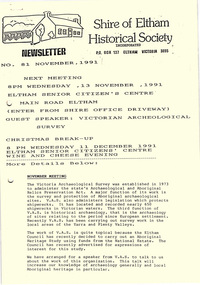 Eltham District Historical Society Inc
Newsletter, No. 81 November 1991
... Archaeological Survey • November Meeting • Christmas Break-up • Eltham... speaker; Victorian Archaeological Survey • November Meeting ...Contents: • Next meeting, guest speaker; Victorian Archaeological Survey • November Meeting • Christmas Break-up • Eltham Festival Parade • School Residence Kangaroo Ground • Andrew Ross Reminiscences The Shire of Eltham Historical Society was formed in October 1967. The first newsletter of the Society was issued May 1978 and has been published continuously ever since on a bi-monthly basis. With the cessation of the Shire of Eltham in late 1994, the Society's name was revised to Eltham District Historical Society and this name first appeared with issue No. 103, July 1995. The collection of the Society's newsletters provides a valuable resource on the history of the Society's activities, office bearers and committee members, guest speakers and subjects of historical interest pertinent to the former Shire of Eltham and the Eltham District.A4 photocopied newsletter distributed to membersnewsletter, eltham district historical society, shire of eltham historical society -
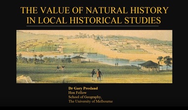 Ringwood and District Historical Society
Mixed media - Video, RDHS Guest Speaker Presentation - "The Value of Natural History in Local Historical Studies" - Dr Gary Presland FRHSV, School of Geography, University of Melbourne
... member of the Victoria Archaeological Survey from 1983 to April... member of the Victoria Archaeological Survey from 1983 to April ...Digitised video (4.41GB). Duration: 63 minutes. Recorded March, 2018. (Video is available for viewing at Ringwood & District Historical Society Archives by appointment)Presenter: Gary Presland is an Australian archaeologist and writer who studied history at LaTrobe University, 1973-76 and archaeology at the University of London, 1977-79. He was a staff member of the Victoria Archaeological Survey from 1983 to April, 1988. His research interests are in the Aboriginal and natural history of Melbourne. -
Phillip Island and District Historical Society Inc.
Book, JORDAN, D.J, East coast shipwrecks : a thematic historical survey, 1996
shipwrecks, victoria, historic sites, underwater archaeology -
 Federation University Historical Collection
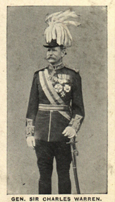
Photograph (black & White), General Sir Charles Warren - South Africa
General Sir Charles Warren was an officer in the British Royal Engineers. He was one of the earliest European archaeologists ofthe Holy Land. Much of his military service was spene in British South Africa. Previously he was police chief, the Head of the London Metropolitan Police during the Jack the Ripper murders. In 1876, the Colonial Office appointed him special commissioner to survey the boundary between Griqualand West and the Orange Free State. For this work he was made a Companion of the Order of St Michael and St George in 1877. He was appointed special commissioner to investigate "native questions" in Bechuanaland and commanded the Northern Border Expedition troops in quelling the rebellion there. In 1879 he became Administrator of Griqualand West. The town Warranton in the Northern Cape Province of South Africa is named after him. In 1882 the Admiralty sent him to Sinai to discover what had happened to Professor Edward Palmer's archaeological expedition. He discovered the members had been robbed and murdered, located their remains and brought their killers to justice. For this he was created a Knight Commander of the Order of St Michael and St George in 1883 , also Knight of Justice of the Order of St John of Jerusalem and in 1884 elected a Fellow of the Royal Society. In 1884 Warren was sent as HM Special Commissioner to command a military expedition to Bechuanaland, to assert British sovereignty in the face of encroachments from Germany and the Transvaal and to suppress the Boer freebooter states of Stellaland and Goshen, which were backed by the Transvaal and were stealing land and cattle from the local Tswana tribes. This became known as the Warren Expedition and achieved its aims without bloodshed. Warren was recalled and in 1885 was made Knight Grand Cross ofthe Order of St Michael and St George. In 1885 Warren stood for election for Parliament but lost the vote. In 1886 he was appointed Commissioner of Police of the Metropolis following Sir Edmund Henderson's resignation. Criticised continually for his decisions and actions he resigned in November 1888. Prior to this time he was appointed Knight Commander of the Order of the Bath, January 1888. On the outbreak of the Boer War in 1899 he returned to service and commanded the 5th Division of the South African Field Force. In January 1990, Warren bungled the second attempted relief of Ladysmith at Tugela River. At the Battle of Spion Kop, January 1990 he had operational command and his failure of judgement, delay and indecision despite his superior forces culminated in the disaster. It has been said that Warren was "perhaps the worst" of the British generals in the Boer War and certainly the most "preposterous". Redvers Buller in a letter to his wife described him as "a duffer", responsible for him losing him "a great chance". Warren was recalled to Britain in August 1900 and never again commanded troops in the field. Individual image from photographed poster of tobacco and cigarette cards.holy land, sir charles warren, british royal engineers, archaeologist, british south africa, london metropolitan police, jack the ripper, colonial office, commissioner, griqualand west, orange free state, companion of the order of st michael and st george, bechuanaland, northern border expedition, warrenton, sinai, professor edward palmer, knight commander of the order of st michael and st george, knight of justice of the order of st johnof jerusalem, fellow of the royal society, knight grand cross of the order of st michael and st george, boer war, redvers buller, knight commander of the order of the bath